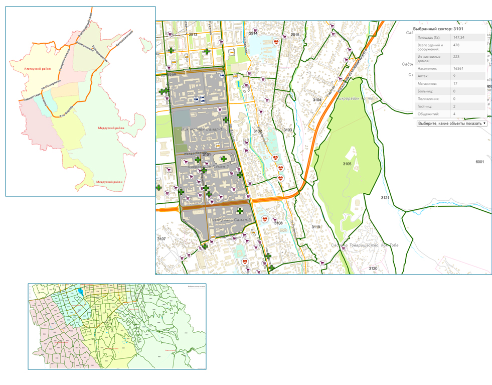
A Sector Map with Possibility to Set Up Quarantine Zones
Covid-19
100%readiness
Start of work:
17/03/2020
Project launch:
27/032020
Status:
Completed
- Detail Almaty GIS-map by sectors
- Update geolocations of nearby drugstores, hospitals, shops
An interactive GIS-map sectormap.uaig.kz was developed to control extensive quarantine zones. Zones’ determination is detailed down to borders of houses where quarantine patients live and to number of people living in this territory. You can also find nearby pharmacies, food stores, hotels and dormitories on the map. Any user can determine his distance from infected areas and take appropriate preventive measures.